Act specifically with more knowledge in crop production.
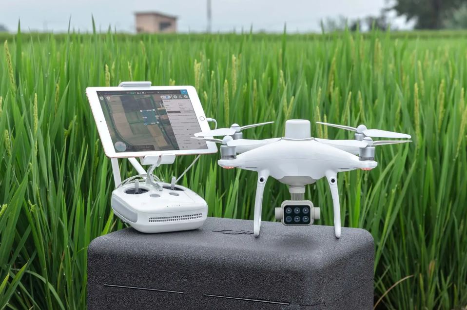
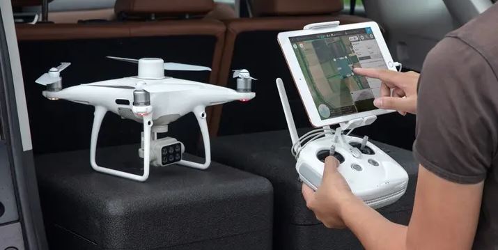
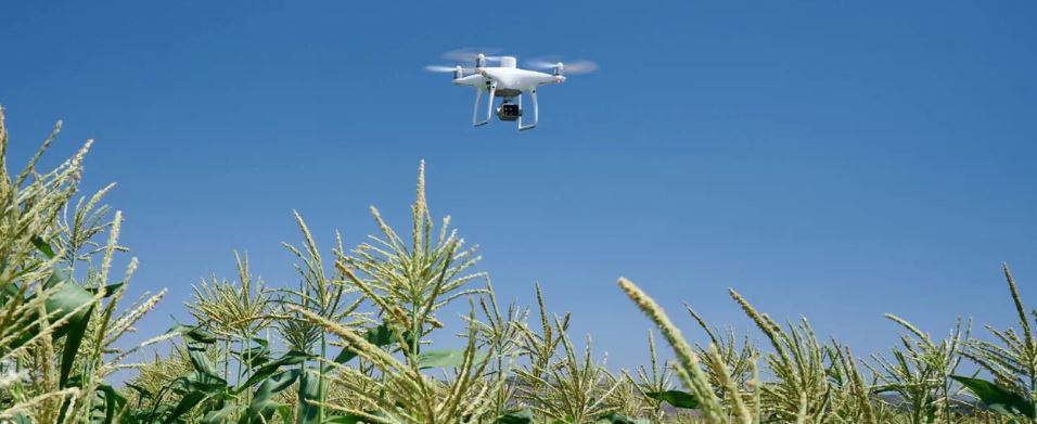
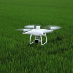
Precise data acquisition at the vegetation level with the P4 Multispectral – a high-precision drone with seamlessly integrated multispectral image processing, developed for agriculture, environmental monitoring or other purposes.
- Multispectral image processing
- Live NDVI view
- RTK module
- TimeSync
Figures from the company
Get immediate insights into plant
health The P4 Multispectral consolidates the process of data collection, which gives an insight into the health status of the plants and helps with the management of the vegetation. DJI developed this platform with the same performance as already known from other DJI drones, with up to 27 minutes of flight time and up to 7 km1 transmission range, thanks to OcuSync image transmission technology.
Perspective down to the surface
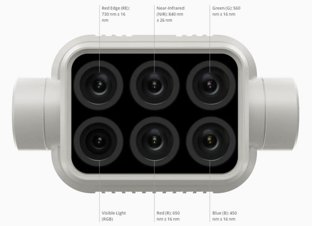
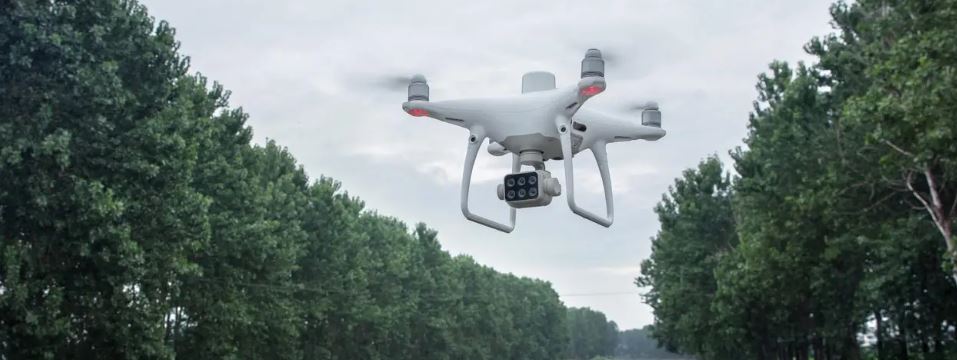
Agricultural recordings are now easier and more efficient than ever before – with the stabilized image acquisition system integrated in the drone, which ensures comprehensive data sets without complicated detours. This gives you access to the information of the RGB camera attached to a 3-axis gimbal and the five spectral cameras (blue, green, red, red edge and near infrared), each with 2 megapixels and global shutter.
Integrated sunshine sensor for accurate results
An integrated spectral sunshine sensor on the top of the drone detects the sun’s rays, thus maximizing the accuracy and consistency of data acquisition at different times of the day. In combination with post-processed data, this information enables the most accurate NDVI values to be obtained.
Valuable data at your disposal.
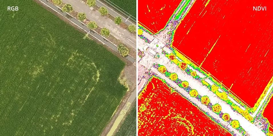
Viewing RGB and NDVI feeds
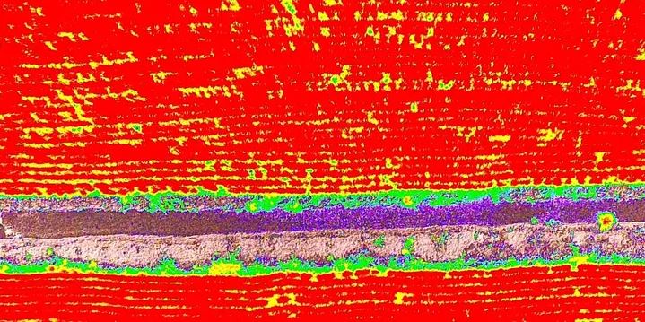
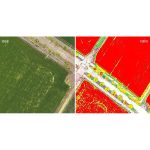
For agricultural professionals who want to know more, aerial photography alone is not enough. You can switch between a preliminary NDVI (Normalized Difference Vegetation Index) view and the RGB view to visualize in real time where decisions to treat vegetation need to be made quickly.
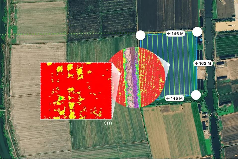
Precision down to the centimeter
With the DJI TimeSync system you get precise position data and centimeter-accurate measurements in real time for each of the six cameras. The TimeSync system continuously coordinates the flight controller, the RGB and NB cameras as well as the RTK module to ensure that each photo uses the most accurate metadata and fixes the position data in the middle of the CMOS. All cameras go through a rigorous calibration process that measures radial and tangential lens distortion. The distortion parameters are saved in the metadata of each image so that the software for post-processing can be customized for each user.
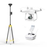
D-RTK 2 Mobile Station and NTRIP compatibility
Integrate the P4 Multispectral with ease into professional work processes. The P4 Multispectral is able to connect to the D-RTK 2 Mobile Station without any problems. In addition, the connection via NTRIP (Network Transport of RTCM via Internet Protocol) 2 and the storage of satellite data for Post Processed Kinematics (PPK) possible.
The Beginning of Intelligent Agricultural Orders Planning
Flights
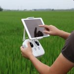
Planning flights, executing automated orders and managing flight data is done with Ground Station Pro – DJI’s leading iOS flight planning app.
Acquiring data
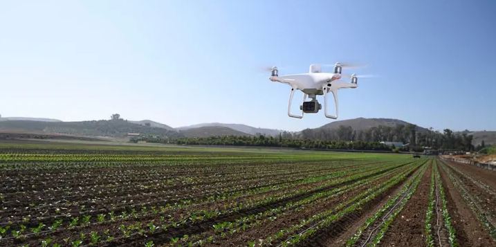
Multispectral images are efficiently collected over a large area with the P4 Multispectral and provide an overview of problem areas.
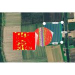
Analyzing data
Using plant-specific metrics and parameters, easy access and processing of air data is possible to achieve the desired results on plant health.
Act data-
based Based on precise drone data, targeted treatments can be implemented in areas that require attention.
Applications
Precise agriculture
During all phases of vegetation, multispectral images can be helpful for Ag professionals by providing invisible information about the electromagnetic spectrum to the human eye. By accessing this data and the subsequently obtained vegetation index data such as NDRE and NDVI, farmers can make timely and informed decisions about the treatment of crops, reduce costs, save resources and maximize yields.
Agricultural surveillance and control
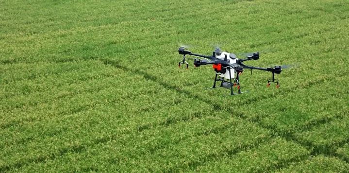
Routine inspections and maintenance work that affects plants can be made smarter and more efficient with the P4 Multispectral – the actionable multispectral findings are used to monitor the condition of forests, measure biomass, map coastlines or manage bank vegetation and, at the same time, habitats or to protect ecosystems and much more.
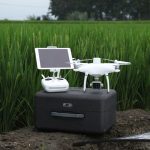
Scope of delivery:
Multicopter:
1x P4 Multispectral aircraft
1x remote control transmitter without display
4x pair of propellers
2x intelligent battery for aircraft
1x charging stroke Intelligent battery
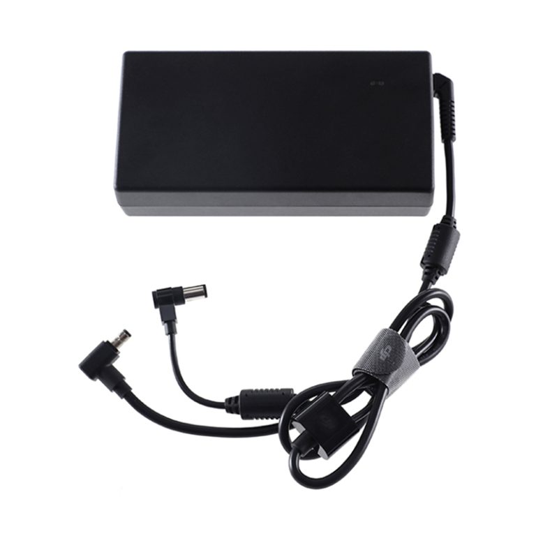
1x power supply
1x power cable for power supply
1x micro USB cable
1x USB cable
1x micro SD card
1x transport box
1x DJI Terra Basic (12 months)
1x DJI Ground Station Pro Team-Professional license (12 months)
1x DJI Enterprise Shield Basic for P4M (12 months)
base station:
1x D-RTK 2 head
1x carbon rod
1x smart device holder
1x charging stroke WB 37
2x intelligent battery (WB37)
1x battery cover
1x power supply
1x power cable
1x MG power cable (Agras series)
1x LAN cable
1x USB-C cable
1x USB-C OTG cable
1x Allen
key 1x battery belt


 Pick up from the Woodmart Store
 Courier delivery
 DHL Courier delivery


Reviews
Clear filtersThere are no reviews yet.